Overview
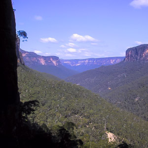
The majestic cliffs of the Grose Valley, from the end of Yileen Canyon, Blue Mountains National Park
The Grose Valley lies at the heart of the Blue Mountains National Park, and the upper Grose is regarded as the cradle of conservation in NSW. At the centre of the valley lies the magnificent Blue Gum Forest, the site of which was the first major conservation battle in the state in 1931. Since then, almost the entire catchment has been reserved in the National Park. The main reason that the valley was able to escape development is the massive cliffs on either side. There are only a handful of easy passes into or out of the valley, and development has been limited to the cliff tops. Much of the valley has recently been preserved as wilderness, further protection for the chasms, canyons and cliffs that make up this spectacular landscape.
The Grose Valley is a bottleneck valley. It is wide in its upper reaches, around the Blue Gum Forest, before narrowing into the Kolonga Canyon, and staying narrow until it emerges on to the plains at Yarramundi. The Grose Valley is bounded to the north by Bells Line of Road, and to the south by the main road across the mountains, the Great Western Highway. The headwaters of the valley are at the Darling Causeway, and the river ends when it joins the Nepean River at Yarramundi.
Access
The Upper Grose Valley is where most of the major bushwalking tracks are. There are a number of access points to the rim of the valley at Blackheath. The three main ones are: Evans Lookout, at the end of Evans Lookout Rd; Govetts Leap, at the end of Govetts Leap Rd; and Perrys Lookdown, at the end of Hat Hill Rd. At Mt Victoria, there is access into the valley from the Victoria Falls Track, at the end of Victoria Falls Rd. Further down the mountains, the Lockley Track can be accessed from Leura, some distance out along Mt Hay Rd.
Over the north side of the valley, the main entrance is via Pierces Pass, at the end of Pierces Pass Rd, off Bells Line of Road.
Further down the valley, the access is more difficult. There are various fire trails that head along ridges from the south, around Lawson, Linden, Springwood and Winmalee, though in general, vehicle access is prevented by locked gates. The best access is from Faulconbridge, along Faulconbridge Ridge where a walking track ultimately leads into the valley.
Entry into the valley in all cases must be made on foot, as none of the roads pass through the cliff lines.
Activities
Abseiling
Bushwalking
Canoeing/Kayaking
Canyoning
Climbing
Mountain Biking
Walks
Rigby Hill
Time: 1 hr Distance: 2km Fitness: E Skill: E Ascent: 60m
An easy and short walk to a fantastic lookout over the Grose Valley.
Hanging Rock and Baltzer Lookout
Time: 4 hrs Distance: 11km Fitness: E Skill: E Ascent: 100m
An easy walk to the impressive Hanging Rock near Blackheath, and to Baltzer Lookout over the Grose Valley
Lockley Pylon
Time: 2 hrs Distance: 7km Fitness: E Skill: E Ascent: 40m
An easy walk to impressive views over the Grose Valley and Govetts Gorge.
Blue Gum Forest via Evans Lookout and Perrys Lookdown
Time: 2 days Distance: 22km Fitness: M Skill: EM Ascent: 750m
The classic walk into the Blue Gum Forest, with camping on grassy flats under the magnificent blue gums
Faulconbridge Ridge to the Grose River
Time: 5 hrs Distance: 17km Fitness: M Skill: EM Ascent: 410m
A longish day walk to visit a great lookout and a beautiful swimming hole
Mt Banks
Time: 5 hrs Distance: 15km Fitness: EM Skill: EM Ascent: 200m
A climb of one of the prominent peaks of the Blue Mountains, with excellent views of the Grose Valley from its slopes.
Victoria Falls
Time: 2 hrs Distance: 4km Fitness: E Skill: E Ascent: 360m
A short but steep walk to a series of pretty cascades on Victoria Creek.
Grand Canyon Loop
Time: 4 hrs Distance: 7km Fitness: E Skill: EM Ascent: 240m
An excellent walk showcasing a variety of the best scenery in the Blue Mountains.
Govetts Leap and the Horse Track
Time: 7 hrs Distance: 13km Fitness: M Skill: EM Ascent: 630m
Visit some of the most spectacular parts of the Grose Valley on this challenging but rewarding walk.
Blue Gum Forest via Du Faur Head
Time: 6 hrs Distance: 12km Fitness: M Skill: EM Ascent: 650m
A challenging and scenic route in to the Blue Gum Forest
Popes Glen and Braeside Tracks
Time: 3 hrs Distance: 9km Fitness: E Skill: E Ascent: 170m
A pleasant and easy walk with spectacular views
Asgard Plateau
Time: 7 hrs Distance: 17km Fitness: EM Skill: M Ascent: 350m
Superb views of the upper Grose Valley, and a good mix of on track and easy off track walking in this less visited area
Pierces Pass
Time: 6 hrs Distance: 15km Fitness: EM Skill: EM Ascent: 540m
A steep descent to the Grose River through a delightful rainforest ravine, with a visit to the magnificent Blue Gum Forest.
Grose Head South
Time: 5 hrs Distance: 15km Fitness: EM Skill: E Ascent: 350m
An easy walk to the highest peak on the south side of the Lower Grose, and some spectacular lookouts.