| Time: | 4 hrs |
| Distance: | 11 km |
| Fitness: | EM |
| Skill: | M |
| Ascent: | 200 m |
| Maps: | LPI Broken Bay 9130-1N 1:25000 |
| LPI Mona Vale 9130-1S 1:25000 | |
| Notes: | Print-friendly notes (opens in new window) |
Introduction
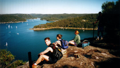
Pittwater from the lookout at the end of the Bairne Track
There are a number of walks in the West Head part of Ku-ring-gai Chase National Park that follow ridges out to lookouts. Most of these involve retracing your route on the way back. This walk links a couple of tracks together in a loop, and in summer would be a good opportunity for a swim along the way. It is best to time this walk so that it is low tide as you make your way around to Towlers Bay. Otherwise you will either have to climb up the steep hillside in places, or get wet feet.
Access
Track notes
From 03 Jun 2001, last checked 03 Jun 2001
Follow the Bairne Track for about 2.5km to its branch with Soldiers Point Track, and take the right fork. This leads after 1km to an excellent lookout over Pittwater.
Backtrack a few hundred metres, looking out for a small path off to the right, as you walk back. It may be marked with a small cairn, and the track down may be marked with tape. Follow this down to near the water's edge and continue around to the right to the secluded beach. This is a nice spot for lunch as it gets relatively few visitors, except from the boats.
From the beach, rock hop around the point, across the creek down the end of the bay, and follow the beach around to Towlers Bay. Facing landward from the small wharf, the Towlers Bay Track goes right towards a building, then sharply left, and contours around the ridge. Bypass the YHA, and at the next fork you can take either path. They both meet further up, and the path climbs to meet the road about 1.5km from where you originally parked your car.
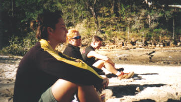
Everyone goes into zombie mode shortly after lunch
Related walks
Bobbin Head Loop
Time: 3 hrs Distance: 9 km Fitness: E Skill: E Ascent: 180 m
A pleasant walk along scenic Cowan Creek to Bobbin Head, and then back via the ridge.
Resolute Track Loop
Time: 3 hrs Distance: 8 km Fitness: E Skill: E Ascent: 180 m
A good walk in summer with some interesting aboriginal sites and numerous lookouts.
Wahroonga to Mt Kuring-gai
Time: 5 hrs Distance: 15 km Fitness: EM Skill: E Ascent: 200 m
A great variety of scenery on this creek and ridge walk through Ku-ring-gai Chase
Hornsby to Mt Kuring-gai
Time: 7 hrs Distance: 21 km Fitness: M Skill: E Ascent: 580 m
An enjoyable section of the Great North Walk with varied terrain
Taffys Rock
Time: 6 hrs Distance: 15 km Fitness: M Skill: EM Ascent: 400 m
An excellent walk to a less visited part of Ku-ring-gai Chase, with excellent views from a number of lookouts