| Time: | 3 hrs |
| Distance: | 7 km |
| Fitness: | EM |
| Skill: | EM |
| Ascent: | 320 m |
| Maps: | LPI Mount Wilson 8930-1N 1:25000 |
| LPI Wollangambe 8931-2S 1:25000 | |
| Notes: | Print-friendly notes (opens in new window) |
Introduction

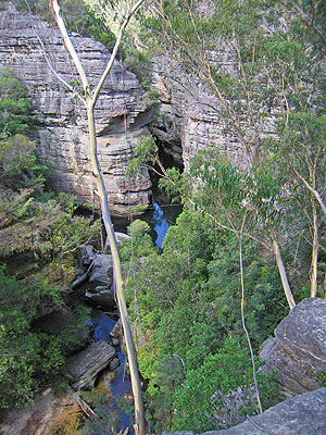
Looking down to the Wollangambe River from the cliffs above
The Wollangambe River is one of the wilder rivers in the state. From where it rises near Clarence in the western Blue Mountains, to where it joins the Colo River, the river lies almost entirely in national park, much of it wilderness. It is a popular canyoning venue, both for liloing down the Wollangambe itself, and for some impressive side canyons which require abseiling to fully explore.
This walk takes you down to the start of the most popular lilo section. It is good in the summer months as you can swim in the deep pools just downstream. The 320m climb out of course is more draining on a warm day, though the top of the hill is in the shade of the massive forest on the rich basalt soil of Mt Wilson.
Access
The walk starts and finishes at the small town of Mt Wilson. To get there, head west along Bells Line of Road and take the signposted Mt Wilson turn off to the right. This is 13km past Mt Tomah Botanic Gardens, and 7km before Bell. Follow the Mt Wilson road for 5km to where it goes around a sharp hairpin bend and up a steep hill. At the top of the hill turn left on to The Avenue, and after 800m park at the fire station on the left.
Track notes
From 08 Feb 2009, last checked 24 Dec 2011
Start by following the fire trail that leads around the back of the fire station. There is a metal sign at the start of this trail. At at T-junction after 200m, turn left on to another fire trail and follow it up the hill. Past the top of the hill, the main trail swings right and then crosses another fire trail. There is a sign saying "Wollangambe River 2.3km" at the head of a foot track opposite that you should follow. The track leads downhill through magnificent warm temperate forest. After a little while you will notice the vegetation change as the track crosses the boundary between the rich basalt soil on top, and the poor sandstone below.
At about 2km a track branches left below a large (10m) sandstone outcrop. Avoid this and continue past another sandstone pagoda on your left. As you near the river, the track swings sharply left. It is worth continuing straight ahead for a short distance to some good vantage points to look down on the river from above. Be careful as none of these are formal lookouts, and they are not fenced.
Return to the track and follow it along the top of the cliffs above a gully for 200m until you can climb down a steep corner on tree roots into the gully. Follow this shady gully down to the river at AGD545912. This is an excellent spot for a swim in the warmer months. You can also see the start of the canyon section, the high narrowing walls and cold deep pool downstream typical of the Wollangambe River below Mt Wilson.
After a break, return the way you came.
Related walks
Bell to Wollangambe Crater
Time: 2 days Distance: 18 km Fitness: EM Skill: M Ascent: 490 m
A relatively easy introduction to the Wollangambe Wilderness. Navigation is reasonably straightforward and there is not too much rock scrambling.