| Time: | 2 hrs |
| Distance: | 3 km |
| Fitness: | E |
| Skill: | M |
| Ascent: | 160 m |
| Maps: | LPI Rock Hill 8931-2N 1:25000 |
| Notes: | Print-friendly notes (opens in new window) |
Introduction

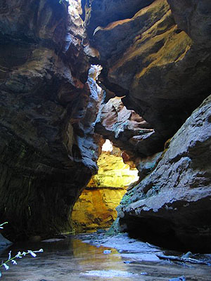
The canyon is almost cathedral-like
The River Caves is a short but spectacular canyon in the upper reaches of Budgary Creek. It has no abseils, and the water in the canyon is knee-deep at its deepest, so can be done as a bushwalk. It is best in late spring as you can enjoy the wild flowers on the walk in and out.
It was discovered in the late 1940s by Russell May and John Norris, back in the day when Budgary Creek was still called Buggary Creek. They called the canyon "The Water Tunnel".
Just visiting the River Caves would make for a short day out and a long drive, so it is worth going to Deep Pass while you are in the area.
Access
The walk starts at the Natural Bridge car park. Getting to the car park is one of the most difficult parts of the walk. It involves some tricky navigation on fire roads. Once off the main Glowworm Tunnel Road, a high clearance 2wd or AWD car is recommended, as there are some rocky sections. Rain may also make those roads impassable to 2wd cars.
Head west along Bells Line of Road, and turn off right at the Zig Zag Railway, about 8km past Bell. Reset your speedo here.

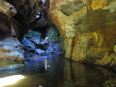
Well lit chamber in the spectacular canyon
Head right again, cross the railway tracks, and keep right as you head up the hill past the sawmill. After 8.8km, turn right at the junction with the Glowworm Tunnel Rd. At 11.1km you pass the Bungleboori Picnic Area on your right. Continue on and at 20.5km, turn right at the end of the pine plantation into Boundary East Forest Rd. At 21.1km turn left at the second intersection at a large clearing, and then at 21.6km veer right at a Y-intersection. At 24.2km turn right at a Y-intersection. A sign points left to Mt Cameron, right to Deep Pass. Note that while you can take the Mt Cameron trail at this point, it crosses Dinner Gully, a 60m descent and ascent, and it is better (particularly if you have a 2wd car) to take this detour. At 25.2km turn left on to a fire trail, about 100m past where another trail branches off right. At 26.6 km turn right as you rejoin the Mt Cameron fire trail. This is just after a steep rocky downhill, usually the most difficult section of the route for low clearance vehicles. At 27.9km you should reach the Natural Bridge car park. There are a couple of steep water bars in this last section, and 2wd cars may bottom out on these. You can park in a number of places before the actual car park, and since this is a loop walk that is an option.
Track notes
From 24 Oct 2004, last checked 11 Jan 2005
From the locked gate at the Natural Bridge car park, walk along the fire trail to the Natural Bridge. The Natural Bridge sounds exciting, but it is just an obvious saddle. From the saddle, turn left down the hill on a track. Just over a km of walking brings you to the main creek junction. Head left, and the canyon starts about 50m upstream. There is no track through the canyon. You will probably get wet up to your knees (you can get wetter if you want). The canyon has a few short sections, with a wide stream bed under high narrow overarching walls. The upper section of canyon is particularly spectacular.
The canyon ends at the creek junction. Turn left, and after about 150m, head left up a steep gully through a break in the cliffs. At the top of the cliffs, head up to the ridge, and then up along the ridge back to the fire trail. There is a rough track to follow up the gully and along the ridge.
Turn left on the fire trail. This brings you back to your car after 300m.
Links
 The River Caves - SleepWhenWeAreDead
Notes and pictures for the River Caves walk/canyon