| Time: | 2 days |
| Distance: | 20 km |
| Fitness: | EM |
| Skill: | EM |
| Ascent: | 80 m |
| Maps: | LPI Howes Valley 9032-2N 1:25000 |
| LPI Mount Yengo 9032-2S 1:25000 | |
| Notes: | Print-friendly notes (opens in new window) |
Introduction
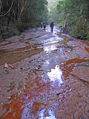
Walking the sandy bed of Howes Valley Creek
Yengo National Park is drier and not as cliff bound as its neighbour to the west, Wollemi National Park. This walk takes you down the pretty Howes Valley Creek to the Macdonald River, where you can camp. While it is possible to simply retrace your route on the second day, for a bit of variety it is worth walking upstream on the Macdonald River instead.
Water can be a problem on this walk if it has not rained for some time. It may be possible to obtain water in some of the side creeks, or alternatively you may need to dig a hole in the sand and wait for it to fill.
The walk can be done as a medium day walk, though there is probably insufficient time to explore downstream.
Access
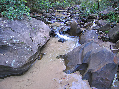
Bouldery section of the Macdonald River
Drive about 74km north of the Ampol service station at Colo Heights to the Macdonald River bridge. Leave a car here, ideally on the south side of the bridge, as the north side has issues with visibility. Drive another 4.2km north to a gate marked "Fire Trail" just over a crest, on your right. Turn in here and you will immediately see a sign on the left saying "Howes Trail" The trail is usually negotiable by 2wd cars as far as Howes Valley Creek, but some care needs to be taken. Head along this fire trail for 1.0km and leave your car here, just near the ford across Howes Valley Creek.
Track notes
From 16 May 2009, last checked 16 May 2009
Walk down to the creek and turn right. Depending on the recent weather, you may be able to avoid getting your feet wet altogether, or you may be wading almost immediately. It is advisable to be prepared for wet feet. A fence needs to be negotiated, and then it is sandy creek walking for quite some distance. The creek widens to become a sandy highway. If the sand is wet you should be able to identify numerous animal tracks in the sand.
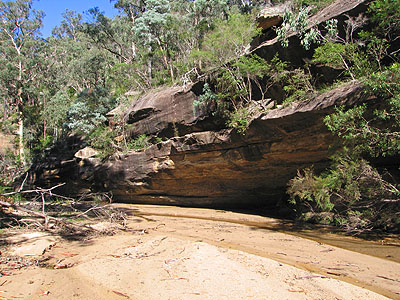
Cliffs on the Macdonald River
At around the 8km mark a boulder blockup needs to be negotiated, but this is fairly straightforward. There is probably another hour or so of walking to the Macdonald River from here. As you approach the Macdonald River junction, the creek narrows somewhat. There should be a decent camping spot on the sandy flats opposite the junction. Otherwise you should be able to find something within a short distance (10 minutes) downstream.
The following morning, you can leave packs behind and explore downstream on the Macdonald River. The cliffs along the river slowly get higher as you proceed. There is an overhang just before the Yokey Creek junction.
Return to your packs and head upstream. The going is similar to the previous day - mostly sandy with brief rocky sections. None of the waterfalls are over a metre! As you near the road there are a couple of stretches of the river that pass through farmland. The river is a right of way, but there are again a couple of fences to negotiate. At the bridge, scramble up the left hand side under the bridge and back to your car.
Personal reports
16-17/05/2009 - Macdonald River: Howes Valley Creek - junction (C) - Macdonald River [Bush Club][L]: on the Sunday morning, explored down the Macdonald River for about 3.5km to the camp cave before exiting back to the Macdonald River bridge (photos)